PROMO -10% on this service!
Advanced and innovative solutions for aerial drone and bathymetric surveying.
Geoservizi carries out topographic and environmental surveys using drones and advanced measurement systems, integrating aerial and aquatic technologies to provide a complete representation of the terrain.
The combined use of drones (UAV) and sensors mounted on floating platforms (USV) enables the acquisition of high-precision data, even in hard-to-reach areas, while reducing time and operational costs.
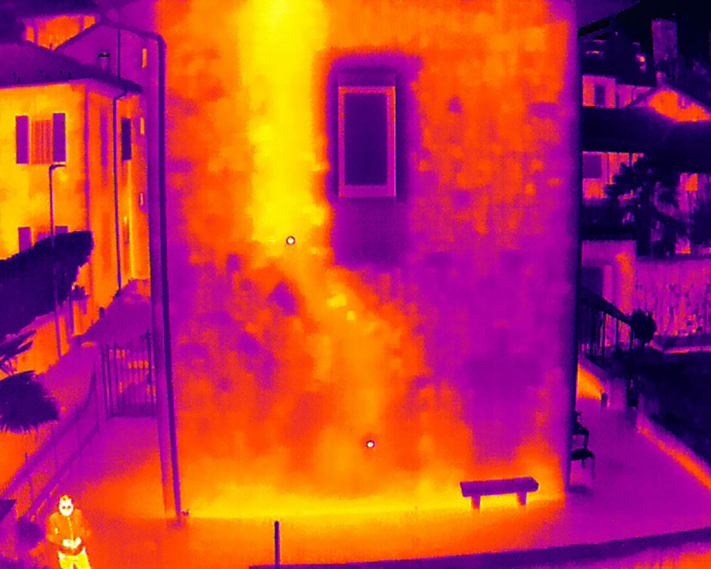
Drone surveys (UAV)
Drone surveys allow the generation of detailed 3D models and high-resolution orthophotos.
- Digital terrain models (DTM) and surface models (DSM)
- Georeferenced orthophotos
- Construction site monitoring and progress tracking
- Morphological and volumetric analysis
- Inspection of difficult or hazardous areas
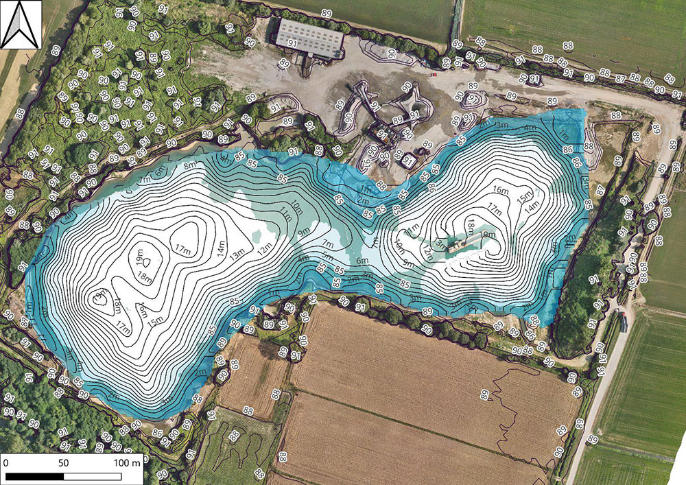
Bathymetric surveys (USV)
Bathymetric surveys are technical investigations aimed at measuring depths and mapping the morphology of lake, river and basin beds.
Measurements are performed using Single Beam or Multibeam echo sounders, installed on boats or remotely controlled floating platforms (USV – Unmanned Surface Vehicle).
- 3D modelling of underwater terrain
- Generation of contour lines and bathymetric maps
- Volume calculations (sediments, excavations, reservoirs)
- Monitoring of morphological changes
- Support for hydraulic and environmental studies
Data integration
The integration of UAV and USV surveys enables the creation of a continuous land–water model, particularly useful for basins, waterways, quarries and hydraulic structures.
Approach
Geoservizi manages the entire process, from survey planning to final data delivery, providing reliable data ready for design and analysis.